
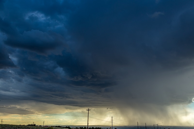
 Summer is here, and although there will be plenty of perfect flying days, pilots should be prepared for volatile weather, such as thunderstorms, which can pop up quickly and unexpectedly. While there are many hazards associated with thunderstorms, this article specifically addresses microbursts.
Formation
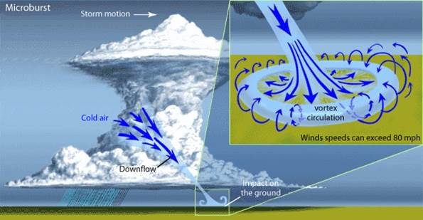
When a thunderstorm develops, the updraft can be so strong that it suspends large amounts of water droplets and hailstones in the upper portions of the cell. Once evaporational cooling occurs within the cell, the updraft begins to weaken. The core is then no longer capable of holding the rain or hail. As a result, the core plummets to the ground and spreads out in all directions. The point at which a microburst first contacts the ground will experience extremely high wind shear, which can cause the greatest damage. Once microburst activity begins, multiple microbursts in the same general area are common and should be expected.
Characteristics
A microburst is a strong downdraft that normally occurs over horizontal distances of 1-2 NM and vertical distances of less than 1,000 feet. Although it is relatively small in scale, an intense microburst could induce windspeeds greater than 100 knots and downdrafts as strong as 6,000 feet per minute. A microburst typically intensifies for about 5 minutes after it initially contacts the ground, and dissipates within 10 to 20 minutes after ground contact.
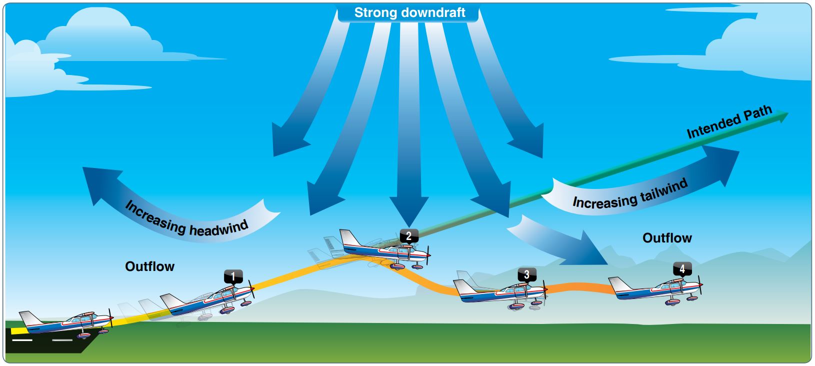
Flying through a microburst can rapidly change the performance of the aircraft and disrupt the normal flight attitude. A microburst can quickly switch from a tailwind to a headwind, causing an increase in airspeed and performance. Conversely, a headwind that changes to a tailwind causes a decrease in airspeed and performance.

A microburst during takeoff or landing is particularly dangerous if the pilot has reduced power and lowered the nose in response to the headwind. This leaves the aircraft in a low-power, nose-low configuration, making it difficult to recover when the wind switches to a tailwind. Due to the potential of a 30-90 knot loss in headwind, the airplane could stall or land short of the runway. It goes without saying that microbursts are the silent assassins we should avoid, as recovery is almost never an option.
Identifying Microbursts
Microbursts are impossible to forecast and difficult to detect. When meteorologists analyze radar data, they look for converging air within the mid levels of the thunderstorm, also known as a mid-altitude radial convergence signature. The figure below shows an example of such radar data. The bright red areas indicate winds blowing away from the radar, and bright green indicates winds blowing toward the radar. High-contrast areas are a strong indicator of wind shear. However, since microbursts are so short-lived, they are difficult to detect as they may occur between radar scans. Although this system is helpful at times, microbursts can still occur with no warning at all.
 Many airports are now fitted with Low-Level Wind Shear Alert Systems (LLWAS) in an attempt to detect microbursts. The system measures wind speed and direction at remote sensor station sites situated around the airport terminal. When there is an indication of wind shear, the remote sensor data is transmitted to a master station, which generates warnings to ATC, which subsequently relays the information to pilots. Wind shear warnings have been further improved in recent years with the development of the Integrated Terminal Weather System, Terminal Doppler Weather Radar, and Weather System Processor. These systems were developed as part of an inter-departmental initiative to avoid microburst accidents entirely.
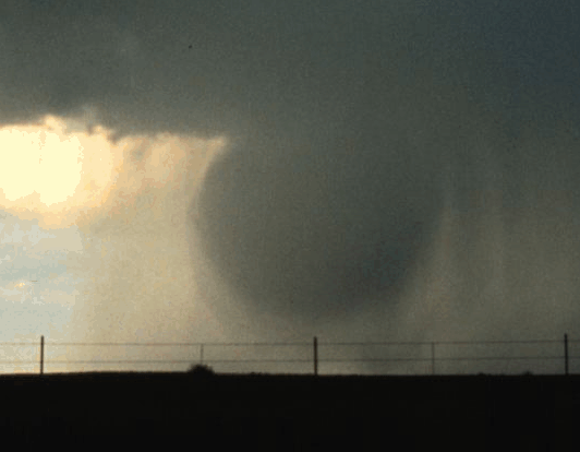
 Pilots should be aware of situations where the probability of a microburst is highest. A visual identification of a possible microburst is virga under cloud bases, particularly under towering cumulus clouds. Virga consists of rain droplets that evaporate before reaching the ground, and has a wispy or shredded appearance. The downward motion of virga is a strong indication that the core of a cloud is weakening and may soon collapse toward the ground.
The risks associated with microbursts are significant—hence, it is in every pilot’s best interest to be informed, aware, and prepared to avoid them. Giving thunderstorms a wide margin of at least 20 miles is recommend for your safety. For more information on microbursts, pick up a copy of the Gleim Aviation Weather and Weather Services or FAR/AIM, and reference AIM section 7-1-26.
Written by: Ryan Jeff (CFI, AGI), Aviation Research Assistant